Understanding how the BWI hydrological forecasting system works

The Blue Water Intelligence system is based on the combination of meteorological data, field measurements, and advanced hydrological models. This integrated approach makes it possible to accurately simulate the evolution of flows and water levels across a watershed. The result: continuous, reliable forecasts tailored to the concrete needs of water resource managers.

From data collection to flow forecasting

Step 1: Indexing the database from multiple sources

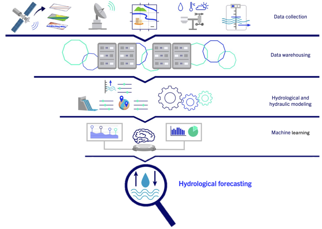
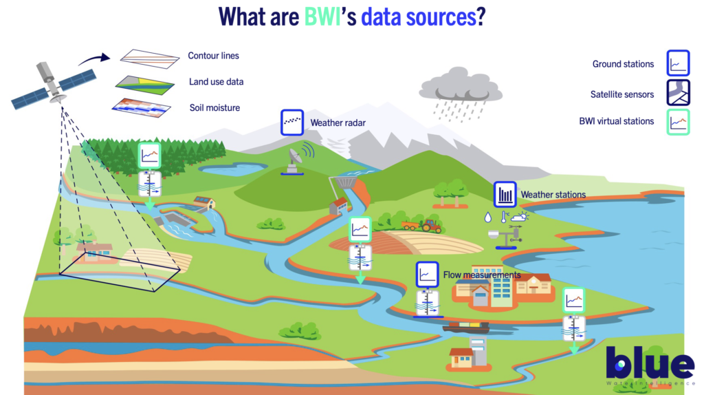
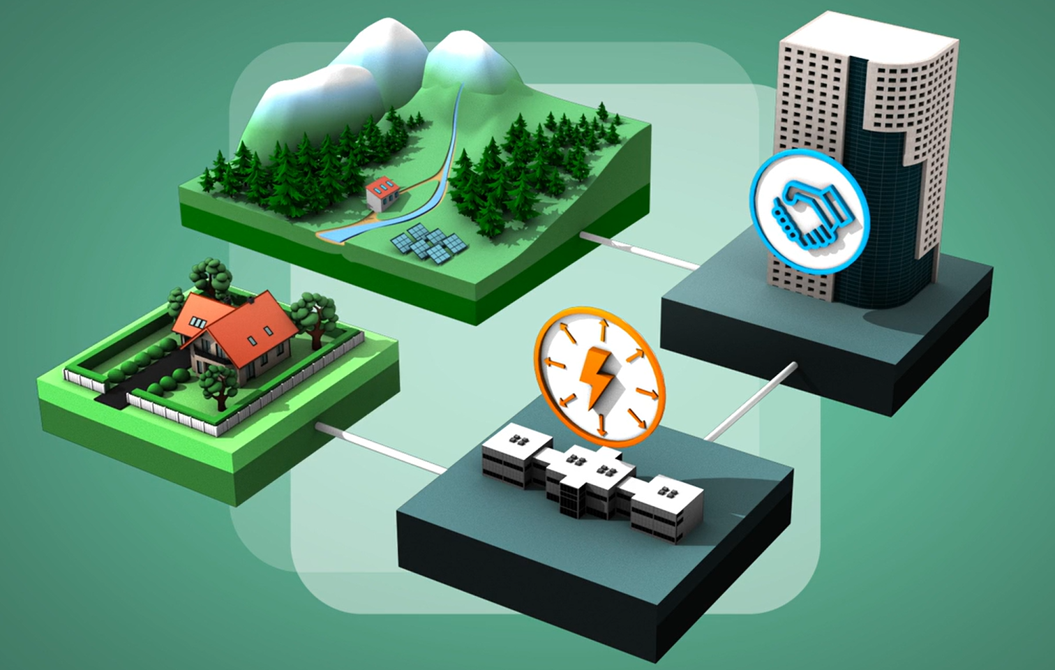
BWI brings together information from different sources: Earth observation satellites, hydrometric stations, forecasts and meteorological data, and local observations. This diversity ensures a solid and representative foundation. This step is detailed below.

Step 2: Storage in a data warehouse

All data is centralized and organized in a secure warehouse located on French territory. This structure makes it possible to maintain a complete history and to facilitate large-scale exploitation.

Step 3: Automated processing by hydrological and hydraulic models

Next, BWI implements advanced hydraulic and hydrological models on this data to compile an initial set of results. The collected data is ingested into models capable of simulating river behavior for each watershed that has been digitized. These models translate natural complexity into actionable results and require prior training before the system goes into production.

Step 4: Machine learning to refine the model results

BWI also uses machine learning, through neural networks, to refine the results produced over time, so that the forecasts take into account the recent acceleration of climate change and its impacts on water resource availability.

Result: hydrological forecasts as accurate as possible

This combination of data, modeling, and machine learning enables BWI to provide forecasts that are as reliable as possible, on a continuous basis. The forecasts thus become, for its users, an additional tool to anticipate, manage, and secure water use.

Focus: The data collection used by BWI systems

Where does the data collected by BWI come from?

Space-based sensors

BWI uses satellite systems to gather multiple data sets and define the natural parameters of the digitized area: digital elevation model, land use and soil moisture, etc.

Physical ground-based measurement stations

Radars and weather stations are also used to collect information on local weather forecasts, both upstream and downstream of the observation point.

In addition, physical hydrometric stations — electronic devices located along rivers — measure in situ the flow and water level of the watershed. These data are necessary for the training and validation of the BWI model.

Virtual stations that BWI users can locate according to their needs

BWI’s virtual stations make it possible to deliver hydrological data digitally by leveraging both spatial and local data. This tool, developed by BWI, is presented in more detail below:

What is a virtual station?

A virtual point on the hydrographic network

A virtual station refers to a point on the hydrographic network where hydrological information (flows & water levels) is estimated. The virtual station is freely placed on the hydrographic network by its user, but it does not physically exist in the field and does not require any physical instrumentation on site. It therefore makes it possible to extend the coverage of the hydrographic network with ease.

A short-term flow forecasting tool

Each virtual station delivers projections as reliable as possible over a horizon of up to 10 days. This short-term visibility helps stakeholders anticipate risks and optimize water resource management.

Classified flow curves

Virtual stations can reconstruct hydrological knowledge and provide flow duration curves. These curves and their time series reflect the frequency and intensity of flows over several years or even past decades. This information facilitates the comparison of hydrological regimes and the monitoring of their evolution over time.

Useful data, easy to interface

Thanks to an easy-to-use and well-documented API, data from BWI’s virtual stations integrates directly into clients’ existing tools (SCADA, GIS, etc.). No need for new software or major changes to your systems — making optimal use of your hydrological forecasts simple and seamless.

Multiple uses for virtual stations

The use of BWI virtual stations and watershed digitization enables new applications, including the implementation of early warning systems, decision-making support for resource allocation (for example, between irrigation and energy) during periods of resource stress, as well as securing construction sites for hydraulic works.

Virtual stations offer significant advantages compared to physical stations.

Virtual stations eliminate the constraints of hardware devices: they are deployed instantly, provide real-time and forecast data, and benefit from machine learning. In addition, virtual stations are not exposed to the risks faced by field-based stations: breakdowns, drift, damage, theft, etc. Their freedom of placement by users on the hydrographic network and their remote operation make them a modern and effective alternative to traditional physical stations. However, virtual stations do not replace physical stations, which remain essential: virtual stations complement existing infrastructures by densifying them and enhancing their functionalities, in a competitive, agile, and coordinated way.

Contact BWI

for any questions

    1