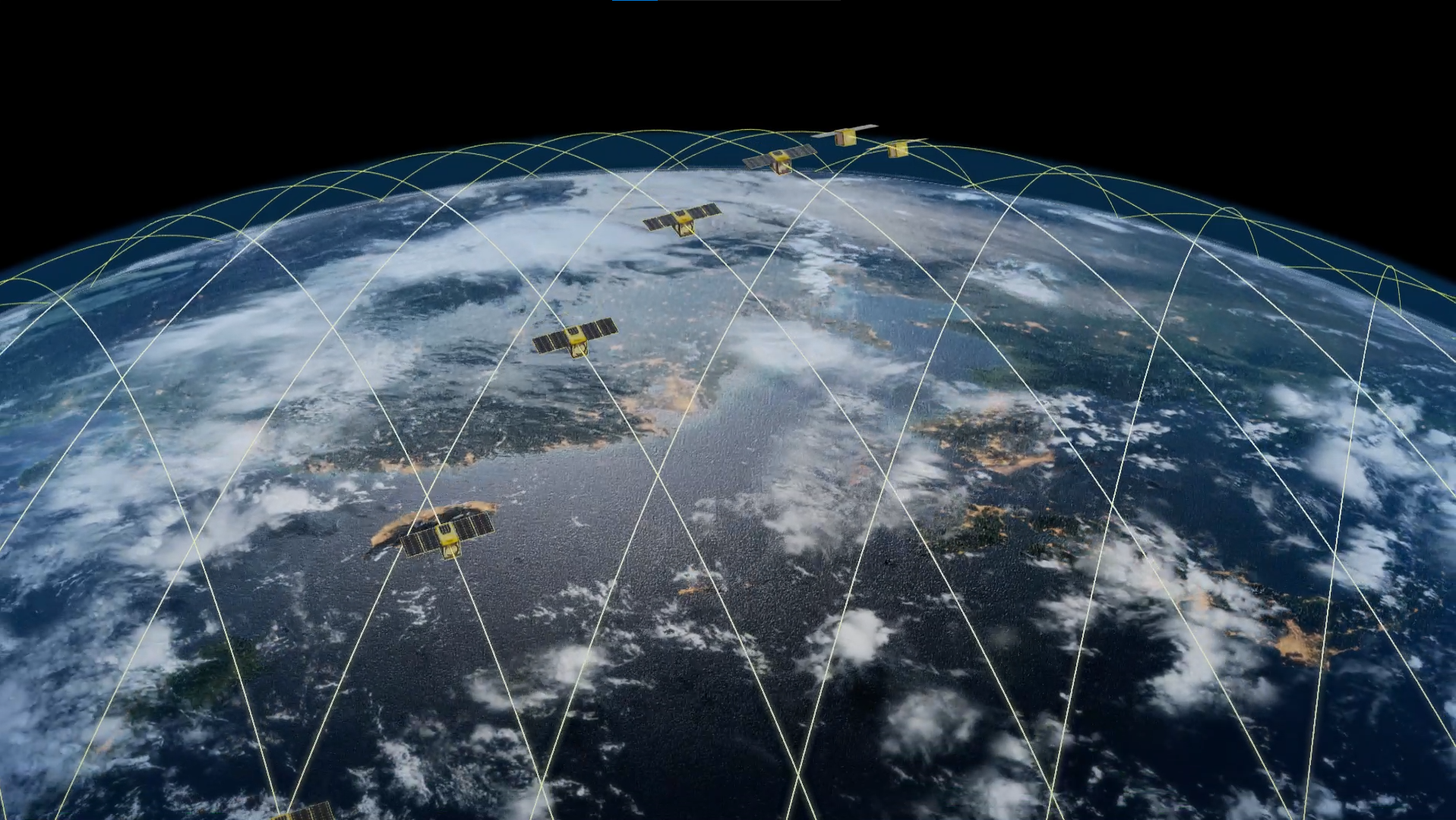
The concept of SMASH shows that a constellation of 10 nano-satellites with nadir altimeters on a single sun-synchronous orbit can provide a daily measure of water levels at rivers wider than 50 m and lakes larger than 100 m x 100 m. Blue Water Intelligence (BWI) plans to launch a minimum viable product of 2 satellites to validate assumptions, followed by a constellation of 10 nanosatellites – all following the SMASH concept to the letter.
Freshwater is a critical resource for the sustenance of life and is of great social and economic importance. Climate change, especially increasing global temperature is severely impacting water availability on local, regional, and global scales. Floods and droughts have increased in frequency and magnitude in the last decades and are becoming harder to predict. The Global Climate Observing System has identified water levels of lakes and rivers as essential climate variables. Most basins under climate stress are ungauged. Furthermore, even the existing in-situ sensor networks are heterogenous in both space and time.
Satellite altimetry was initially designed for oceanography. It has been exploited to complement in-situ measurements for hydrology ever since the launch of Topex/Poseidon in 1992. However, such adaptations of altimeters lead to data losses over continental water bodies making the processing complex. The launch of the SWOT mission (2022), first ever with a dedicated hydrological mask, promises accurate water level prediction. This applies for all rivers wider than 100 m and lakes larger than 250 m x 250 m. Assuming SWOT fulfills its promises of accurately mapping water bodies, it still falls short of recommended (daily) temporal resolution. SWOT has a revisit rate of 21 days, like other single satellites in a repeat track orbit (10 days (T/P, Jason), 27 days (Sentinel-3), 35 days (ERS2, ENVISAT, SARAL)).
The recent advancement in nadir altimeter technology makes it possible to mount it on a nanosatellite. The French space agency (CNES) in partnership with LEGOS, a research laboratory, studied the feasibility of a constellation dedicated to continental surface water (codename: SMASH). The concept of SMASH shows that a constellation of 10 nano-satellites with nadir altimeters on a single sun-synchronous orbit can provide a daily measure of water levels at rivers wider than 50 m and lakes larger than 100 m x 100 m.
Blue Water Intelligence (BWI) plans to launch a minimum viable product of 2 satellites. The aim is to validate assumptions, followed by a constellation of 10 satellites – all abiding by the concept of SMASH. The compact altimeter optimized for continental hydrology has a high backscattering coefficient (SNR > 10 dB for sigma0 min = 27 dB) which allows a small antenna (~35cm) and low transmitted power (PT < 0.5 W). The reception window is set with onboard DEM validated on previous altimetry missions. The Ka-band altimeter (3200 MHz bandwidth) will operate on low-resolution mode (10 cm altitude accuracy), with no radiometer onboard, and a bi-frequency GNSS for a 5 cm radial POD requirement.
Hydrological masks with around 30,000 preset virtual stations (crossing between tracks and water bodies) around the globe will limit data acquisition and transmission requirements. A ground station near the North pole will enable NRT availability of data (~6 hours lag). Altimeter constellation, together with SWOT, can provide basin management authorities, risk managers and scientists with indispensable measurements to build climate resilience.
By monitoring water levels in rivers and water bodies, it is possible to provide early warning of potential flooding events. This information can be used to evacuate people and deploy resources to affected areas, potentially saving lives. We could use forecasts and tools built on top of monitoring data to guide decisions on water allocation and management, ensuring sustainable use of this critical resource.
Accurate and objective shared source of data on water levels, with common biases for upstream and downstream countries, can help reduce disagreements and disputes over water resources. This shared information can help facilitate dialogue and conflict resolution between countries or regions in a transboundary basin. Apart from above mentioned applications, improvement in ecosystem and inland water transportation management, and advancement in our understanding of the hydrological cycle and hydroclimatic systems are other key prospects of a high revisit altimeter constellation dedicated to inland continental surface water observation.
Reference to the inventors of the SMASH concept:
Blumstein, D., Biancamaria, S., Guérin, A. & Maisongrande, P. (2019, December). A potential constellation of small altimetry satellites dedicated to continental surface waters (SMASH mission). In AGU Fall Meeting Abstracts (Vol. 2019, pp. H43N-2257).